NBT photo guide 2: Your tablet loves geotags!

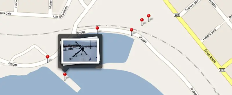
Photography is a hobby of mine and after doing a photo related article last week I realized that there are several ways of using tablets as photography tools, so I turned that article into the first in a hopefully extensive series of articles about this subject. This time I want to cover geotagging, which is basically when photos are tagged with GPS coordinates so you can go back and look at where it was taken later- or simply view a map with dots placed for each photo taken. Great for vacations and trips where you don’t necessarily remember exactly where a picture was taken after a while. Unfortunately, geotagging is still not a very common feature on cameras, only smartphones. Here’s how you can fix that and really take advantage of your tablet’s ability to display geotagged photos!
The cameras on smartphones and tablets these days are decent by some standard, but you don’t need an expensive camera to surpass their image quality by a LOT. DSLRs are becoming very popular these days because of the low price (compared to a few years ago) and the image quality on even the most low cost DSLR camera can’t be matched by any convergence device camera- not even close. That’s why cameras still have a place in society despite them being integrated in anything these days. The downside is that most cameras don’t have a GPS, and even though some companies try to scam you into believing that a Wifi-locator can substitute a GPS it’s really quite useless if you’re nowhere near a supported Wifi network. Luckily it’s quite easy to add GPS data to the photos coming from your camera.
All you really need besides your camera is something that has a GPS receiver and can track your movement and export it to a log file. I’m a geocacher so I already have a Garmin Oregon 450 GPS receiver that can do this. Many people have GPS units in their car, and this feature is pretty standard so it might be on yours if you have one. If not, a GPS enabled smartphone can also be used via third party software like GPStrack ($1, iOS) or Open GPS Tracker (free, Android). No matter how you do it, the result should be the same: a .GPX file (or similar format) with information about your route, timestamped.
To actually get GPS data, you need to use your GPS tracker system while taking pictures. I just hang my Oregon 450 on my camera bag and it sits there quietly recording where I move and when. When I’m done, I export a GPX file which then has all that data stored. You then use a computer program (such as the free GeoSetter) to sync the GPS data with your photos. This is done by matching the time the photo was taken with your location at that time, so naturally your camera and GPS unit need to agree on what time it is. This is a batch process (it can do it for multiple photos at once) so it’s really not a big extra step to add to your photo organizing efforts. Once done, your photos will have the GPS information stored in their EXIF data (internal information system, part of the image file).
When all that is done, just transfer your photos to your tablet and go nuts. The iPad has a dedicated tab called “places” in the photo viewer which will populate a Google Map with the locations your photos were taken, and I’m told Android has the same feature (if not, there’s plenty of third part software that does). This way you can browse photos in a whole new way and really relive your photographic adventures. Now that Google Maps is going 3D in Android 3.0, this feature should get even better. My grandmother travels a lot all over the world and unfortunately she’s the wrong generation for this sort of technology, but I know this system would have been perfect for her if she could use it- just imagine showing off your vacation photos overlaid on a map showing exactly where the photos were taken.
Of course you don’t need a tablet to be able to display geotagged photos on a map, but let us be honest: the whole photo viewing deal is a hell of a lot smoother on a tablet than on any computer program. Tablets are basically highly advanced digital photoframes (or photo albums) so taking full advantage of the geotagging feature is something every photo enthusiast should consider doing.
For more of our tips on using your tablet as a photography tool, click here.

